Jadual Kandungan
Bukit Jalil
Dirujuk oleh
1867-1874: Mungkinkah ada Kaitan dengan Raja Jalil?
Sekitar 1867-1874, Raja Jalil adalah antara hulubalang yang terlibat bersama dengan Tengku Dhiauddin dalam Perang Selangor, menentang Raja Mahadi. Pusat kegiatan beliau ketika itu ialah di Kuala Garing, Rawang, iaitu di sebelah utara Kuala Lumpur. Bukit Jalil terletak di sebelah selatan Kuala Lumpur. Selain jaraknya yang jauh itu, setakat ini tidak terdapat sebarang tanda-tanda kaitan di antara keduanya: “The number of durian and other fruit trees shew that Batang Berjuntai was once a somewhat flourishing kampong; it was abandoned during the disturbances between Raja Mahdi and Tunku dia Udin's parties some fifty years ago. The village is on the Rawang-Kuala Selangor Road, 13 1/4 miles from Kuala Selangor and about 18 miles from Rawang; it was reopened about a year ago; possesses a Police Station, with a haltingroom for travellers, and Barracks. The newly appointed Penghulu, Raja Jalil, has, contrary to ancient Malay practice, selected a pretty site for his house on a hill over-hanging the river. … The Penghulu, Raja Jalil, is an old fighting man and formerly served on the side of Tunku dia Udin, holding a fort at Kuala Garing, where he was unfortunate enough to blow away most of his fingers of his right hand.” (Pinang Gazette and Straits Chronicle, 26 April 1894, Page 3: |"NOTES OF THE RESIDENT'S VISITS TO DISTRICTS IN SELANGOR, 1894").
1905: Mercu Tanda
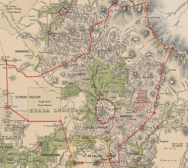
Kiri: Peta persempadanan polis daerah Kuala Lumpur sekitar 1906-1908, ditandakan merah. Bukit Jalil adalah satu mercu tanda persempadanan polis di antara Kuala Lumpur dan Ulu Langat: “Police District. Kuala Lumpur. Description: Commencing at Gunong Seping and bounded thence on the southeast by a line bearing southwesterly to Bukit Chenuang, on the east by a line bearing southerly to Bukit Blachan, again on the southeast by a line bearing southwesterly to Bukit Sungei Puteh, again on the southeast by a line bearing southwesterly to Bukit Sungei Besi, on the east by a line bearing southerly to a point on the District boundary between Kuala Lumpur and Ulu Langat bearing due east from Bukit Jalil, thence on the south by a line bearing westerly to Bukit Jalil, again on the south by a line bearing westerly to Bukit Permatang Kumbang, on the west by a line bearing northerly to a point due east of the southeastern corner of Sungei Buloh Forest Reserve, again on the south by a line bearing westerly to the southwestern corner of the Sungei Buloh Forest Reserve aforesaid, on the southwest by a line bearing northwesterly to Bukit Puyuh, again on the west by a line bearing northerly to Bukit Mayang, on the north by the District boundary between the Districts of Kuala Lumpur and Ulu Selangor bearing easterly to the State boundary on main range and thence again on the east by the State boundary bearing southerly to the point of commencement. - S? H. ?” (Arkib Negara 1957/0140546W, 05/02/1908: |"EUROPEAN POLICE OFFICER TO BE STATIONED IN KAJANG").
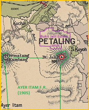
Kanan: Paparan dekat di bahagian persempadanan selatan (petak jingga), menunjukkan Peta Bukit Jalil (bulatan merah) dan kawasan sekitarnya. Bukit Jalil adalah bucu sempadan sebelah timur laut Hutan Simpan Ayer Itam (diwartakan 1905). Di sebelah utaranya ialah Bukit Jalil Estate (dibuka 1910).
(Berdasarkan peta Edinburgh Geographical Institute, 1904 @ Yale University Library - Digital Collections: |"Selangor, Federated Malay States, 1904 / John Bartholomew & Co ; W.T. Wood, chief draftman").
Perihal Bukit Jalil Estate (1910).
1929: Peta Sekitar Bukit Jalil
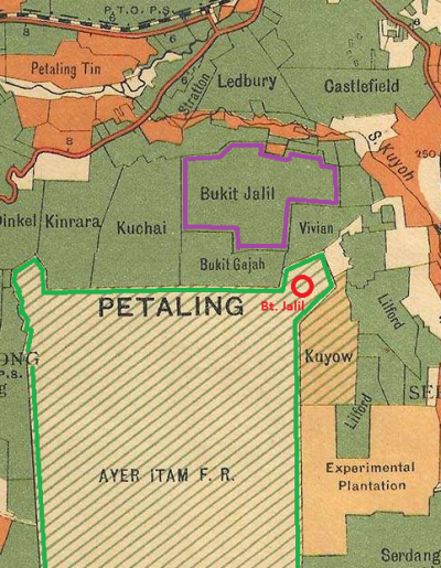
Peta sekitar Bukit Jalil, 1929. Bukit Jalil yang asal ditandakan dalam bulatan merah, iaitu bucu timur laut Hutan Simpan Ayer Itam (diwartakan 1905). (berdasarkan peta Edward Stanford @ F.M.S. Survey Department, 1929: |"1929 F.M.S. Wall Map of Selangor (Kuala Lumpur)")
1950: Peta Sekitar Bukit Jalil
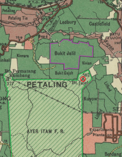
Peta sekitar Bukit Jalil, 1950. Bukit Jalil yang asal ditandakan dalam bulatan merah, iaitu bucu timur laut Hutan Simpan Ayer Itam (diwartakan 1905). (berdasarkan peta Surveyor General, Malaya, 1950 @ Australian National University: |"Malaysia, Malaya, Selangor 1950, Land Use, South Sheet, 1950, 1:126 720").
1995: Pembinaan Kompleks Sukan Negara
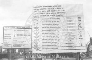
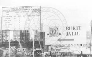
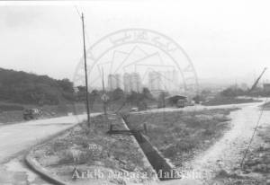
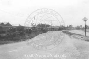
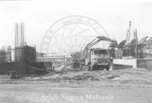
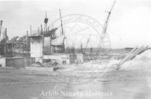
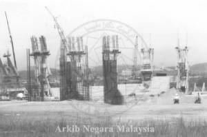
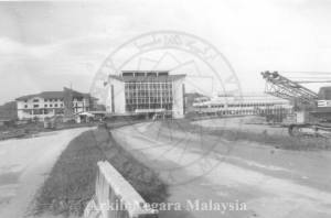
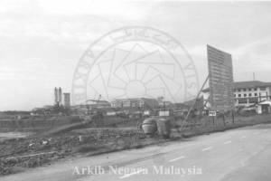
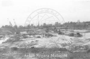
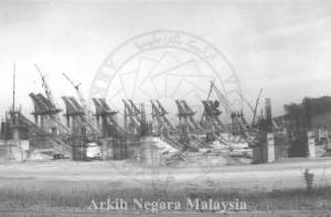
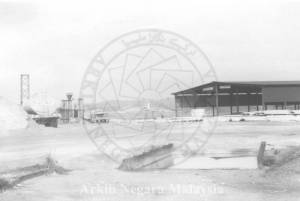
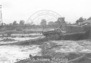
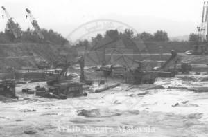
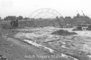
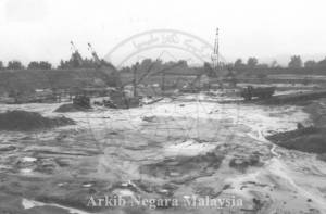
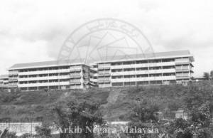
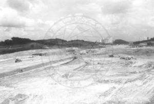
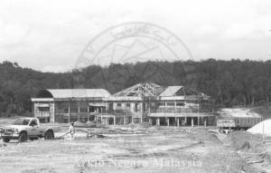
Pembinaan Kompleks Sukan Negara (Arkib Negara, 14/08/1995: 2000/0014595W; 2000/0014596W; 2000/0015010W; 2000/0015012W; 2000/0015013W; 2000/0015014W; 2000/0015015W; 2000/0015017W; 2000/0015018W; 2000/0015019W; 2000/0015022W; 2000/0015025W;2000/0015026W; 2000/0015028W; 2000/0015029W; 2000/0015030W; 2000/0015073W; 2000/0015076W; 2000/0015077W);
Kini
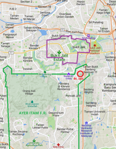
Peta Bukit Jalil dan kawasan sekitarnya, kini (Mapcarta).
| Nama asal | Diasaskan | Kini |
|---|---|---|
| Bukit Jalil | ? | Taman Puncak Jalil (PUJ 9) |
| Hutan Simpan Ayer Itam | 1905 | Hutan Simpan Ayer Hitam (HSAH), UPM/SISFEC |
| Bukit Jalil Estate | 1910 | Bukit Jalil |
| Laman Utama | Hubungi Kami | ||||||||
| Siri Cebisan Sejarah: | Bangi | Gambang | Hutan | Ipoh | Kajang | Kuala Lumpur | Kuantan | Pulau Pinang | Hubungi Kami |
